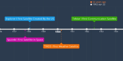
1 abr 1960 ano - TIROS I First Weather Satellite
Descrição:
At this point in time, people were finally able to know the weather throughout the world. This could take many pictures of the Earth while it was in space if it was near enough to the ground. "When the satellite was within range of a ground station, the cameras could be commanded to take a picture every 10, or every 30 seconds. But each camera was also connected to a clock controlled tape recorder to record images when the satellite was beyond the range of a ground station. Each recorder contained 400 feet (122 m) of tape, and could record up to 32 pictures for playback the next time the satellite was in range." - https://noaasis.noaa.gov/NOAASIS/ml/40yearsa.html "When the satellite data was read out at either of the CDA stations, it was recorded on 35-mm film for making prints and large projections. From these, a hand-drawn cloud analysis (nephanalysis) was made then transmitted by facsimile to the U.S. Weather Bureau National Meteorological Center (NMC) near Washington, D.C." - https://noaasis.noaa.gov/NOAASIS/ml/40yearsa.html This led to what we now have today, we still have many weather satellites, although they are much more advanced with the technology that we now have.Adicionado na linha do tempo:
Data:
1 abr 1960 ano
Agora
~ 65 years ago