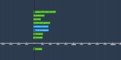
1 janv. 150 - stick maps
Description:
Stick charts were made and used by the people of marshal to navigate the Pacific Ocean by canoe off the coast of the Marshall Islands. The charts represented major ocean swell patterns and the ways the islands disrupted those patternsAjouté au bande de temps:
Date:
1 janv. 150
Maintenaint
~ Il y a 1877 ans